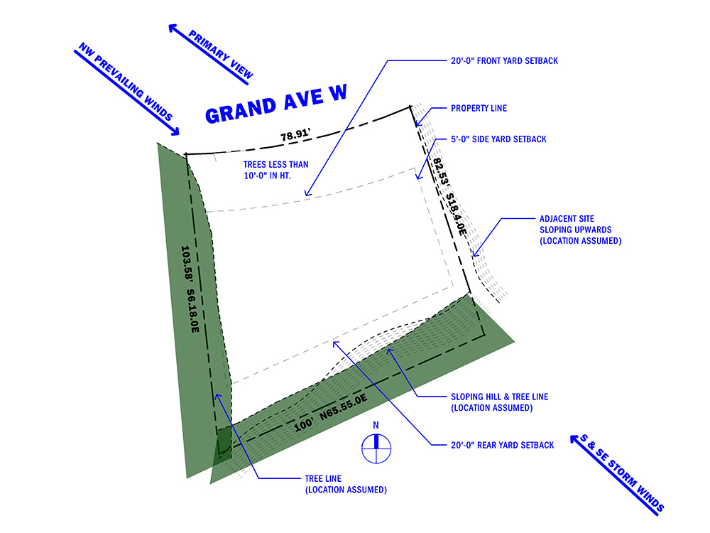
Often when a client is looking to purchase a lot (or already has a lot) a pre-design step I take is providing a site analysis. The major point of this is to look at site constraints and opportunities which can help to see if it’s a good fit for the proposed project’s scope. For this step in the process, I will use an actual lot for sale in Astoria to explain my process.
This lot is located along Grand Ave West, which features one of Astoria’s iconic views looking toward the Megler Bridge.
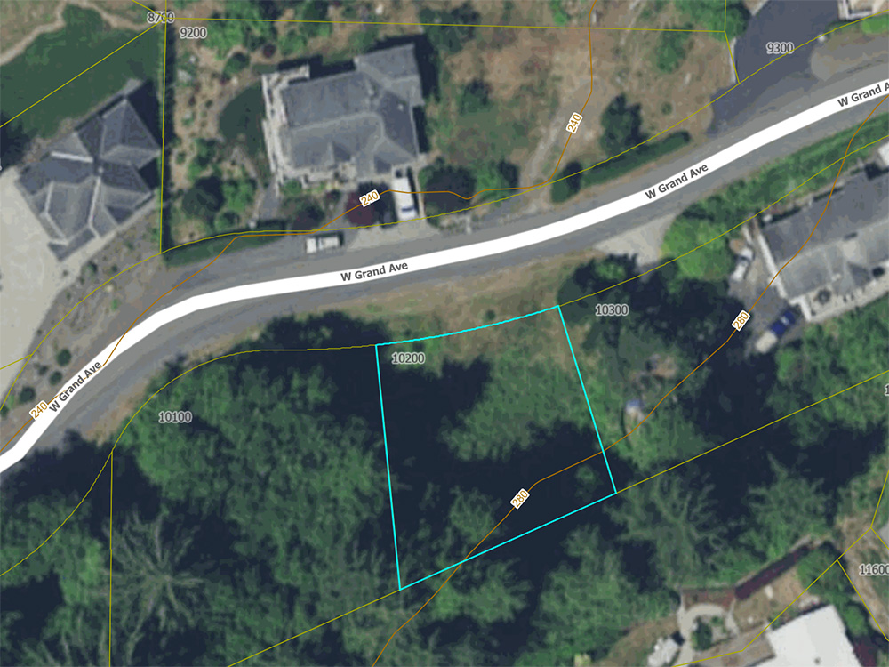
When I visit a potential site with a client it’s primarily to find out what they love about it. Of course, it’s also a time to look for opportunities and possible challenges. I did a quick visit to this site for further understanding beyond just the property lines and aerial view of the site conditions.
Some observations:
- The lot’s grade is lower than the adjacent developed property, as well as the rear yard which steeply slopes up.
- There is a lot of dense foliage surrounding the relatively flat lot.
- Limited solar exposure through foliage.
- Natural buffer from storm winds.
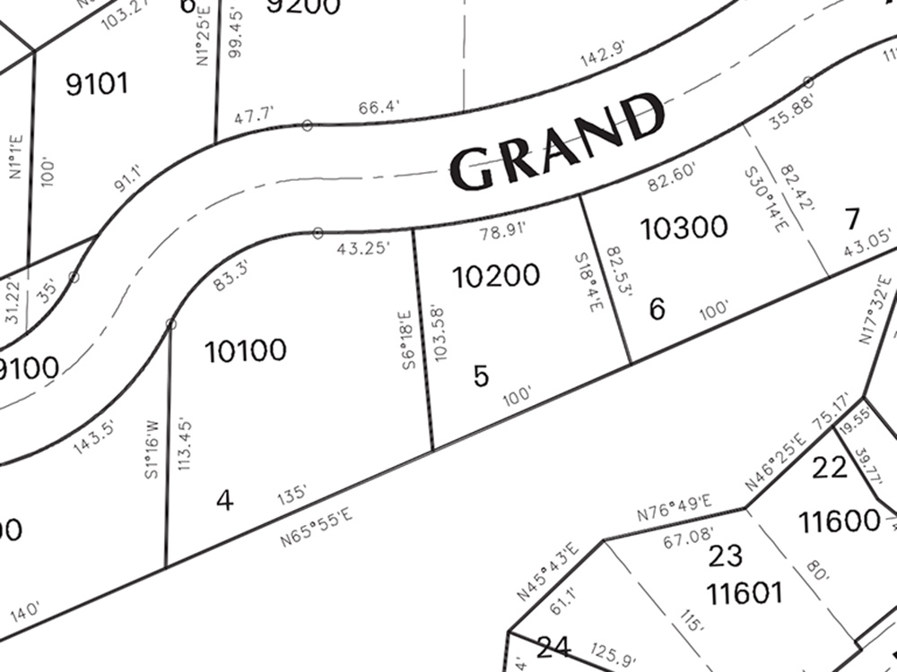
Prior to having a survey done on the lot (which is a necessary process once the lot is selected), there are a few steps I take in my site analysis to use accurate numbers. First, using Clatsop County’s GIS (Geographic Information Systems) database on tax lots, I can get some info about the lot (primarily the actual property lines). On the website, there is a boundary survey from 1990 for the lot as well.
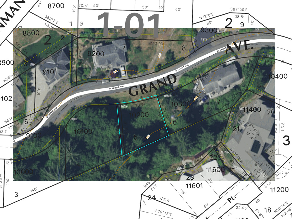
Overlaying this with the aerial view, there are some differences. This reiterates the need for a survey.
Astoria’s Development Code for R-1 (Low Density Residential Zone), provides the following restrictions: minimum front yard setback is 20 feet, the side 5 feet, and rear 20 feet. The height limitation is 28 feet above grade.
From this information, using CAD I created a basic site using the property line lengths and bearings. The setbacks were then added from the Development Code. What this site plan lacks is accurate contours and major vegetation. On this site, that information is important for the exact location of foliage in relation to the property lines, however, it is still useful for pre-design analysis.
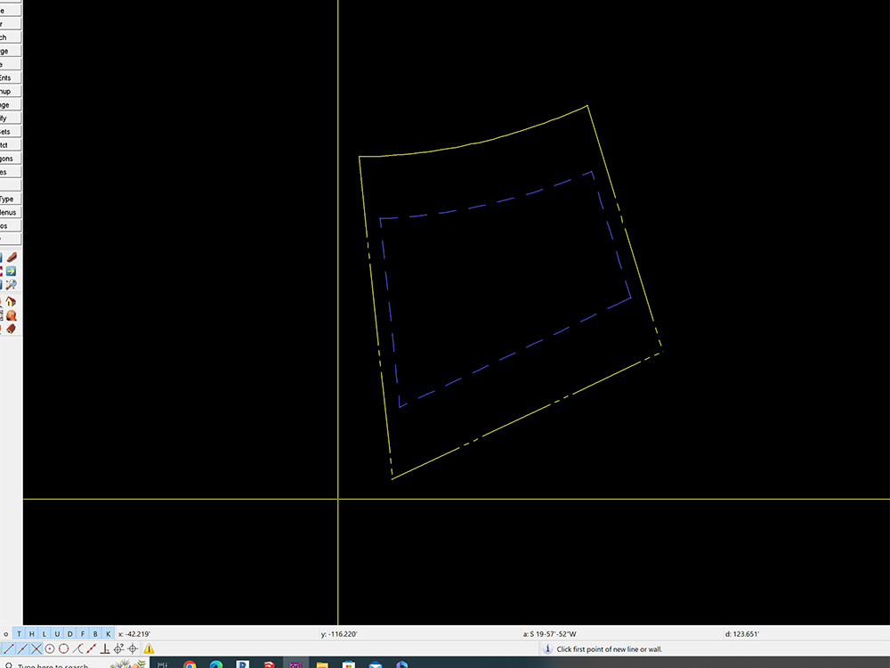

The benefit of this basic site plan is that an early design program can be tested. Roughly how much square footage is available on grade level (factoring in a driveway, etc) can be determined. Given that the lot sits lower in elevation, primary view considerations might need to be positioned on a second floor.
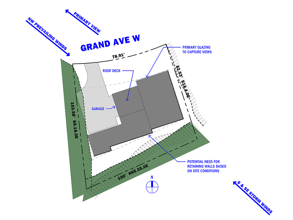
Here a schematic building footprint is shown. In this early concept, rather than a street-facing garage, it is turned with driveway space to maneuver. This would allow the smaller lot and street-facing side not to be dominated by the garage door.
On the preliminary plan, the heavy black lines indicate possible locations where retaining walls might be required. On the front of the plan, the blue-grey lines indicate glazing. This would be similar on both levels. Another thought would be a roof deck since the site limits development on the rear yard side.
While this goes beyond just site analysis, it helps to explore possibilities with the site and see if those work within the client’s needs.

